Whistler Maps and Orientation
(Whistler, British Columbia - BC, Canada)
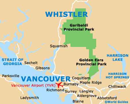
Located within British Columbia and one of the most popular of all Canada's many winter skiing destinations, Whistler is a leading resort town with a thriving tourism scene. Whistler is relatively close to Vancouver, which lies just over two hours to the south and around an hour north of the town of Squamish, which is known for its Stawamus Chief granite dome and subsequent rock climbing activities.
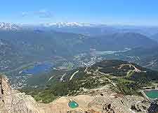
Virtual year-round skiing in the area is the reason that this part of
Canada has become so incredibly popular, and the area is really divided into two notable mountain resorts - Blackcomb and Whistler. Each of these busy resorts features their very own set of ski lifts, chairs, and slopes.
Maps and Orientation of the Town
Whistler Village is the name given to a cluster of accommodation, restaurants and shops, and this spot does tend to the focus of much aprés-ski socialising. Maps are available at the Whistler Activity and Information Centre on Whistler Way, next to the TELUS Conference Centre, and also the local Visitors Center on Gateway Drive.
- Abbotsford - 188 km / 117 miles ( two hours and 30 minutes, south-east)
- Burnaby - 135 km / 84 miles (one hour and 55 minutes, south)
- Chiliwack - 129 km / 80 miles (two hours and ten minutes, south-east)
- Coquitlam - 152 km / 94 miles (two hours and 15 minutes, south)
- Gibsons - 128 km / 80 miles (two hours and 30 minutes, south)
- Golden Ears Provincial Park - 102 km / 63 miles (one hour and 55 minutes, south-east)
- Harrison Hot Springs - 251 km / 156 miles (three hours and 15 minutes, south-east)
- Harrison Lake - 270 km / 168 miles (three hours and 40 minutes, south-east)
- Langley - 165 km / 103 miles (two hours and 25 minutes, south)
- Maple Ridge - 163 km / 101 miles (two hours and 25 minutes, south)
- Pemberton - 33 km / 21 miles (40 minutes, north)
- Richmond - 139 km / 86 miles (two hours and 15 minutes, south)
- Sechelt - 148 km / 92 miles (two hours and 50 minutes, south-west)
- Squamish - 60 km / 37 miles (one hour and ten minutes, south)
- Surrey - 163 km / 101 miles (two hours and 25 minutes, south)
- Vancouver - 126 km / 78 miles (two hours and 20 minutes, south)
- Victoria - 242 km / 150 miles (four hours and 30 minutes, south)
Map of Canada

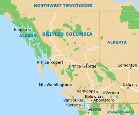
Map of British Columbia
Map of Whistler